Our house has the privilege of being located in the Hoces del Cabriel Natural Park, the largest protected area in the Valencian Community, declared a UNESCO Biosphere Reserve In 2019. Its landscape of Mediterranean and riverside forests stretches along the Cabriel River (the historic dividing line between Valencia and Castile-La Macha) which winds through spectacular canyons (hoces) in this area.
The possibilities are endless in this region of inland Valencia. We have selected our favorite spots so you can easily enjoy the surrounding nature, including their precise location, distance from the village and suggested routes.
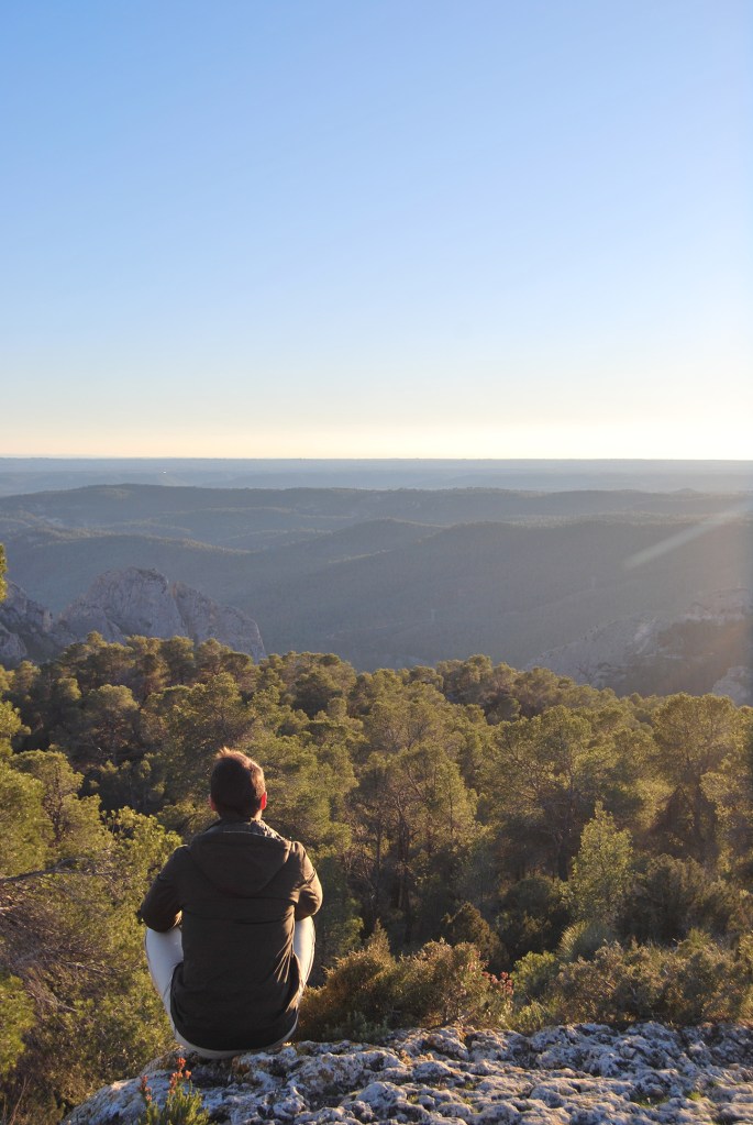
Canyons Viewpoints (Miradores de las Hoces)
Google Maps (Parking) | 20 km away
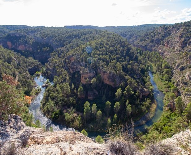
The hoces are narrow valleys where the river describes a very sharp curve and the Park full of these. By following this 15 km route (PR-CV 344 trail) throuhg the viewpoints, you will enjoy breathtaking views of the Rabo de la Sartén, Vicente, and Purgatorio canyons (pictured in the photo).
Peñas Blancas Viewpoints
Google Maps | 20 km away
An easily accesible viewpoint just a 4.5 km walk from this parking lot on the CV-4661 road, (the old N-III road). It is well-signposted (Route 6) and includes a variant to another impressive viewpoint directly above the Cuchillos de Contreras (Route 5).
On your way, you can stop to discover the optical telegraphy tower, an interesting 19th century communication system. You are also close to Villargordo del Cabriel, where you can stop for lunch at the Raïmblanc restaurant.
Hoz del Retorno Recreational Area
Google Maps | 16 km away
A century-old poplar grove by the river with picnic benches and nearby walking paths. Leaving the car in the abandoned village of Casas de Cárcel, or in the Villatoya, we suggest the following walks:
Hoz del Tete Recreational Area
Google Maps | 18 km away
A swimming area with easy car access (paved road until 2 km before the destination). You can reach the river via a simple 5 km circular walk. From March to November, rafting is available from Tamayo to this area; check with active tourism companies like Aiguaroca, Ruting o Avensport.
Vadocañas Bridge
Google Maps | 20 km away
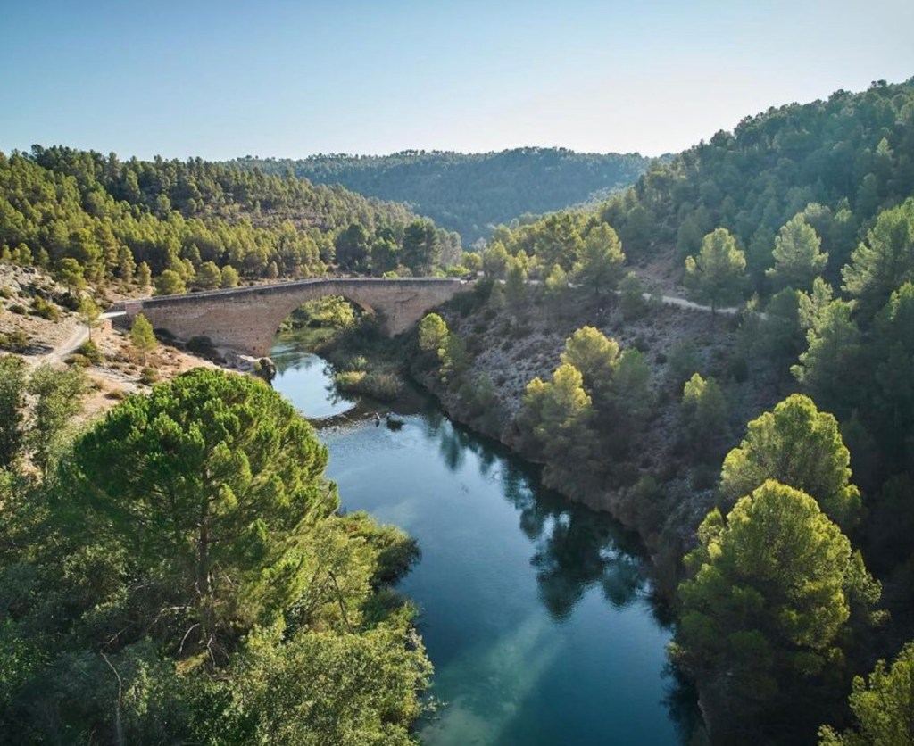
A historic viaduct from 1575 that uses an ancient Roman road to link Cuenca with Valencia. It has a swimming area at its feet.
Even though it’s accesible by car, the last 12 km are on a forest track and many visitors prefer to go by bike following the «blue route» from Venta del Moro. You can rent bicycles at hummibikes in Requena.
Once a the bridge, we recommend a beautiful 17 km round trip route along the river to Los Cárceles.
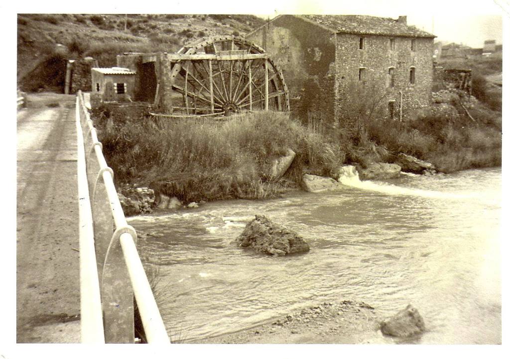
Noria de los Basilios (Waterwheel)
Google Maps | 20 km away
Many waterwheels (norias) are found along the Cabriel River, used to lift water for irrigation. The Basilios wheel is on the right bank. You can access it via several routes from Los Cárceles; we recommend the 11 km circular route, which also passes by the remains of the abandoned Utiel-Baeza railway line.

Cuchillos de Contreras
Google Maps | 28 km away
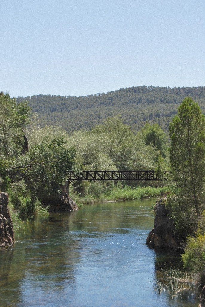
Spectacular landscapes in deep canyons with a historic iron bridge. This easy 8 km round-trip route starts at the Venta de Contreras, at the foot of the dam, where you can also eat or buy a picnic.
Note: Please confirm if the route is open as the path has been temporarily closed since September 2023 due to legal disputes. If closed, you can still visit the area from above via Route 5 (Peñas Blancas).
Noria de Casas del Río (Waterwheel)
Google Maps | 46 km away
The only irrigation waterwheel in the Valencian Community that has remained active since the 18th century, featuring a swimming area. On your way, we recommend a detour to Los Pedrones to visit the Hoya de la Iglesia Creamery, Bodegas Dussart Pedrón, or enjoy a Gazpacho Manchego at Bar Juani.
Discover More
In addition to these spots, we regularly update our Wikiloc profile with tracks to help you discover this unique natural setting on foot, always following safety recommendations. In the house cupboard, you will find backpacks in case you want to take some food and enjoy and unforgettable picnic in the wild.
If you prefer to explore by bicycle, you can follow the Wineland initiative tracks with your own bike or renting one in Hummibikes (Requena). For adventure activities, consult the wide range of proposals from Aiguaroca, Ruting o Avensport.
Finally, don’t forget that in Venta del Moro you can find the Natural Park Interpretation Center, offered by the Generalitat Valenciana, which offers maps and personalized suggestions every day from 9:00 AM to 2:00 PM (+34 963 189 222 | Google Maps).